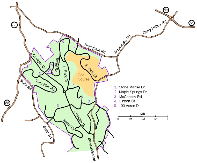
From the north on Route 88 (Library Rd): Take Corrigan Dr south for 0.5 miles.
Turn left onto 100 Acres Dr and follow it for 0.6 miles to the Diana Grove on the right.
Marked on the map with a purple triangle.
From the south on Route 88: Turn Right on Brownsville Rd Ext and go for 2.0 miles. Then continue on Brownville Rd for 1.3 miles. Turn Left
onto Corrigan Dr and go for 1.7 miles to 100 Acres Dr. Turn right and follow 100 Acres Dr for 0.6 miles to the Diana Grove on the right.
Marked on the map with a purple triangle.
From the east on Route 51: Take Curry Hollow Rd west for 1.3 miles; contiue on Brownville Rd for 0.3 miles and make a slight Right
onto Broughton Rd. Go 1.1 miles on Broughton and turn Left onto East Park Dr. Go 100 yards on East Park and bear right onto 100 Acre Dr.
Go 0.4 miles on 100 Acre Dr and bear right onto Texas Rd. Go 0.5 miles on Texas Rd bear right onto 100 Acre Dr.
Follow 100 Acre Dr for 0.2 miles to the Diana Grove on the left. Marked on the map with a purple triangle.
Here is a Google maps link to the
Diana Shelter.
The GPS coordinates of the entrance are 40.325214 N, 80.014256 W

