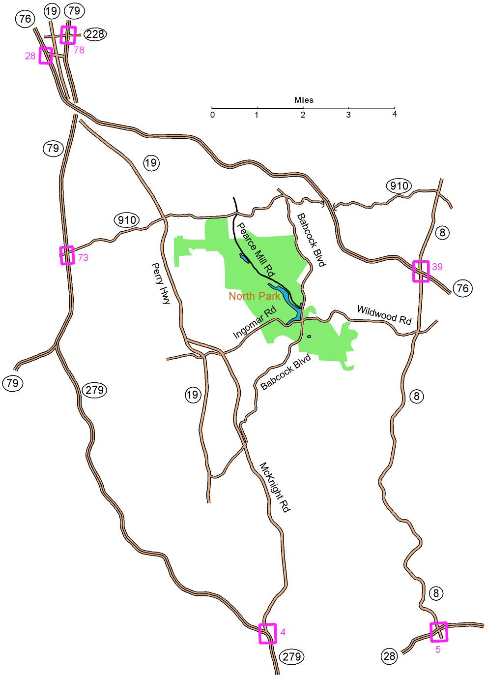
From the East: At turnpike (I-76) exit 39, take Route 8 south (1.3 miles).
Turn right onto Wildwood Rd. This will become Ingomar Rd; continue
on it for 2.9
miles to the light at Babcock Blvd. Turn right onto Babcock;
go for 0.2 miles and turn left onto Pearce Mill Rd. After
0.2 miles, bear right onto N. Ridge Dr. Follow N. Ridge Dr for
1.6 miles to parking on the left; watch for the WPOC banner.
From the South (on I-279): Take
McKnight Road (exit 4) and follow McKnight Rd 6.4 miles north to
Ingomar Rd. Bear right at the exit and follow Ingomar Rd about
2.1 miles until it crosses Babcock Blvd. Turn left onto Babcock and follow the directions in bold above.
From the South (on Route 28): Take
Route 8 north (exit 5) about 7.4 miles. Turn left onto Wildwood
Rd. This will become Ingomar Rd; continue on it for 2.9 miles to the light at Babcock Blvd. Turn right onto Babcock and follow the directions in bold above.
From the Northwest: At
turnpike (I-76) exit 28 (or at I-79 exit 78 via Route 228 west), take
Route 19 South (7.7 miles) to Ingomar Rd. (Don’t follow
Truck Route 19.) Turn left and follow Ingomar Rd about 2.7 miles
until it crosses Babcock Blvd.
Turn left onto Babcock and follow
the directions in bold above.
Here is a Google maps
link to the Wyoming Shelter