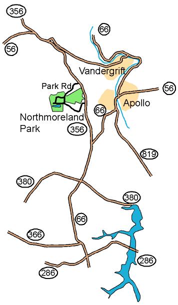

From
the South: From the crossing of Route 22 and Route 66 at
Delmont,
take Route 66 north for 12.2 miles to the point where Route 66 and
Route 356 meet. Bear left onto route 356 and continue for 2.7
miles to Park Rd. Turn left onto Park Rd and follow it into
the
park. Follow Red and White Orienteering signs to parking.
We are at shelter #2.
From
the West
and North: From Route 28, take exit 17 onto Route 356 south.
Follow Route 356 for 9.7 miles to Park Rd. Turn
right onto
Park Rd and follow it into the park. Follow Red and
White
Orienteering signs to parking. We are at shelter #2.
Here is a Google maps link to the location of the shelter
GPS coordinates: 40.582270 N, 79.604102 W