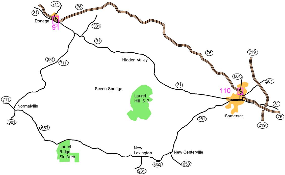

From Donegal, PA Turnpike exit 91:
Take Route 31 East and 711 South 2.5 miles. Turn right onto 711
South and 381 South. Go 9.6 miles to Normalville; there turn left
onto 381 South. Go for 0.2 miles; then turn left onto 653 East.
Follow 653 East for 5.7 miles to Laurel Ridge S.P. and follow red and white orienteering signs to registration.
From Connellsville:
Take Route 711 East for 8 miles to Normalville. Then proceed as above onto 381 South.
From Somerset, PA Turnpike exit 110:
Take Route 601 South (Center Ave) to Routes 281 South and 31 West
(Main Street). Turn right onto Main St and go until Route
281 South splits off to the left. Continue on Route 281 South for
7.7 miles to New Centerville where 281 South merges with Route 653
West. Follow 281 South and 653 West 2.9 miles to New Lexington.
There bear right onto 653 West and go 7.6 miles to the Laurel
Ridge S.P. and follow the red and white orienteering signs to registration.
From Route 219 east of Somerset:
Take the exit for Route 31 West or Route 281 South and follow them
until they merge (on Main Street). Then, follow the directions
for Somerset above.
Here is a Google maps link to the park entrance
The GPS coordinates are 39.955277 N, 79.369863 W