Directions to Keystone State Park (west side)

Directions to Keystone State
Park (west
side)
From U.S. Route 22
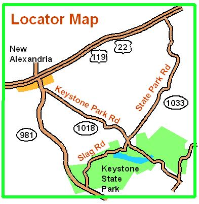
in New Alexandria, take Route 981 south for 0.25 miles to Keystone Park
Rd. Turn left onto Keystone Park Rd (SR
1018) and follow it 2.5 miles to the Keystone State Park. Turn right onto Slag Rd
and go 0.6 miles
to registration (shelter #2). If you reach the beach, you missed the
right turn.
Here is a Google maps link to where
pavilion #2 is.
The GPS coordinates of pavilion #2 are 40.374689 N, 79.394303 W