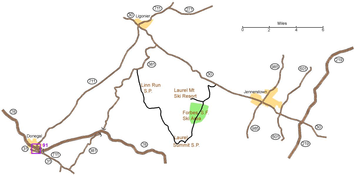
Directions to Forbes State Forest Ski Area

Directions to Forbes State Forest Ski Area
From Donegal, exit 91 of PA turnpike: Left onto Route 31 for 0.3 miles. Turn left onto Route 711 North; go for 12.8 miles to Ligonier.
From Ligonier: Take Route 30 east for 7.5 miles. Turn right onto Laurel Summit Rd. Go for 2.5 miles to the Ski Area Warming Hut. Watch for red and white orienteering signs.
From Route 219 east of Jennerstown: Take Route 30 west for 6.9 miles. Turn left onto Laurel Summit Rd. Go for 2.5 miles to the Ski Area Warming Hut. Watch for red and white orienteering signs
Here is a Google maps link to
the Warming Hut.
The GPS coordinates of the entrance are 40.15667 N, 79.14972 W
The street address is 1120 Laurel
Summit Rd, Boswell, PA